Building detailed polygons with useable co-ordinates.
Posted: Fri Nov 19, 2010 10:29 am
G'day.
To avoid this tutorial becoming a mammoth waste of your precious time please take a moment to consider the following:
Reasons for -
I want to make detailed polygon shapes (as detailed as I want) with borders that align perfectly.
Reasons against -
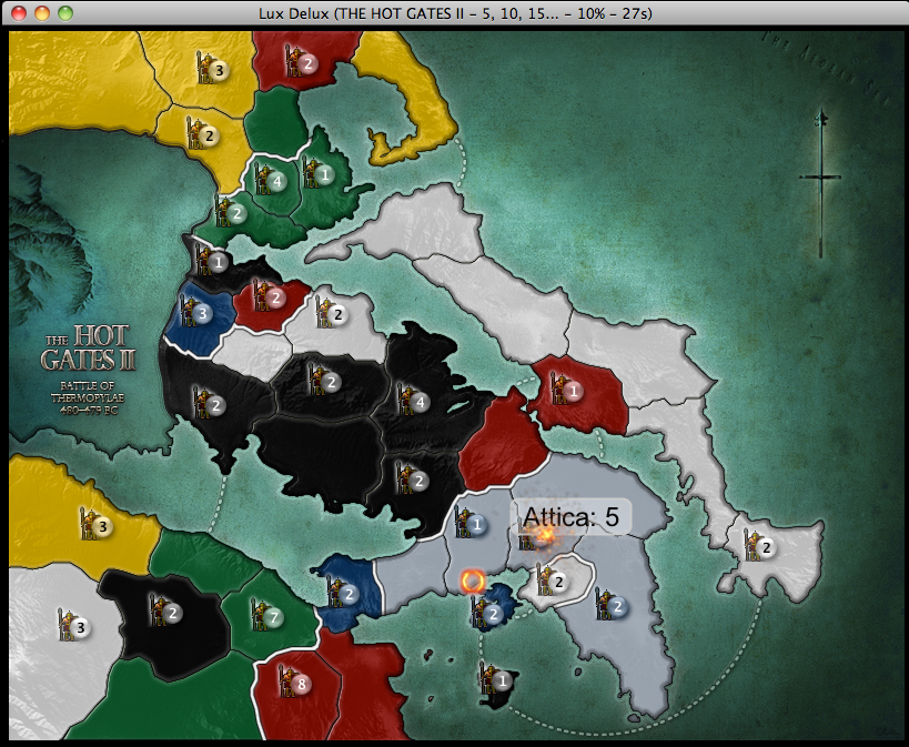
My map doesn't require a lot of detail. Good maps don't need a lot of detail. If I wanted to make detailed maps I'd find a much better way of doing it than this.
Bottom line is - there's more than one way to skin a cat, this one works for me.
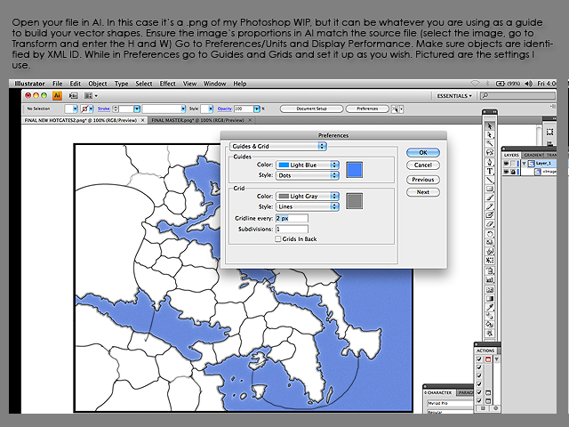
Stuff you'll need: Adobe Illustrator. Lux Delux, registered if possible. A word processing program. A few spare hours.
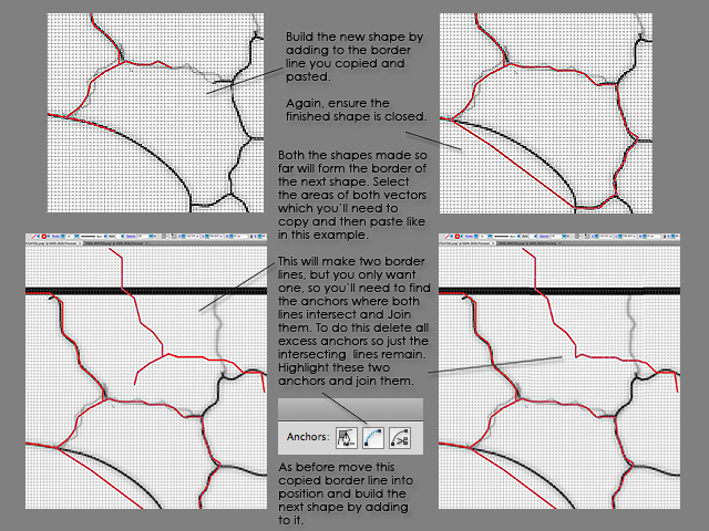
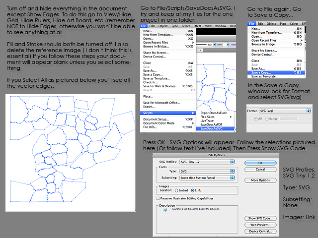
Fast forward - you’ve now built all the vector shapes that will form the countries and continents of your map.
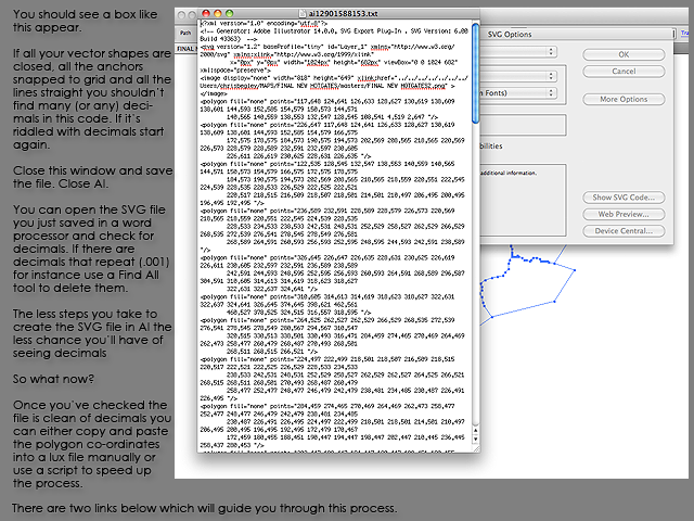
Edited to add - If decimals do find their way into the code they are often very low or very high: Like a .008 or .997 for instance. If the decimals are close to forming a whole number I round up.
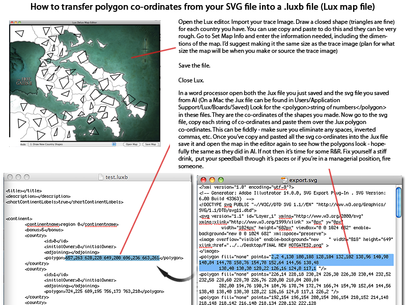
If you are unsure how to transfer the polygon co-ordinates into a .luxb file read on.
Also - If you are having trouble getting results from this tutorial or think my method sucks you might want to have a look at <a href="http://sillysoft.net/forums/viewtopic.p ... ">this.</a> simpler approach.
If you'd like to try using a script to transfer the data read <a href="http://sillysoft.net/forums/viewtopic.p ... ">this.</a>
To avoid this tutorial becoming a mammoth waste of your precious time please take a moment to consider the following:
Reasons for -
I want to make detailed polygon shapes (as detailed as I want) with borders that align perfectly.
Reasons against -
My map doesn't require a lot of detail. Good maps don't need a lot of detail. If I wanted to make detailed maps I'd find a much better way of doing it than this.
Bottom line is - there's more than one way to skin a cat, this one works for me.
Stuff you'll need: Adobe Illustrator. Lux Delux, registered if possible. A word processing program. A few spare hours.
Fast forward - you’ve now built all the vector shapes that will form the countries and continents of your map.
Edited to add - If decimals do find their way into the code they are often very low or very high: Like a .008 or .997 for instance. If the decimals are close to forming a whole number I round up.
If you are unsure how to transfer the polygon co-ordinates into a .luxb file read on.
Also - If you are having trouble getting results from this tutorial or think my method sucks you might want to have a look at <a href="http://sillysoft.net/forums/viewtopic.p ... ">this.</a> simpler approach.
If you'd like to try using a script to transfer the data read <a href="http://sillysoft.net/forums/viewtopic.p ... ">this.</a>